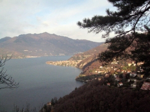
The starting point is at the old port of Luino. Here, turn into Via Cavallotti. At the end of the street, turn left into Via Pellegrini and then right into Vicolo S.Carlo and walk on until the crossing with Via Sbarra; turn right and get to P.zza S.Francesco. From here, turn left uphill into Via Jacobino da Luino and walk up as far as the intersection with Via Lugano and Via Carnella. Keep left and go along Via Carnella and then Via Belvedere winding uphill towards the highest point of Località Carnella. At the end of the paved road, turn right and walk along the path winding at half slope as far as the sign of a short diversion on the left leading to a panoramic viewpoint over Luino and the lake. Go back to the path that leads to the junction to the path to Bonga, which you leave on the right, and arrives at Località Gaggio, Via Chopin, where the paved road starts again. Reach the crossing with Via Bach and walk uphill on the right until you cross Via Strauss; turn right and go along Via Gaggio, past the beginning of the mule track on the left. Continue along the paved road and reach the start of the path on the left which will lead you downhill on the rather steep hillside to Colmegna at the junction with SS394 Luino-Zenna. Walk alongside the lakefront of Colmegna and reach a flight of steps branching off the SS394 on the right. Turn into Via Casneda and climb up the mule track until you reach the crossing with Via Castello; turn right here and walk on as far as the crossing with Via Berra. Keep to the left at the following crossing with Via Torretta and walk up this street on the left until you reach the end of the built-up area and the beginning of the path to Agra and Maccagno on the left. Now the path winds up at half slope, past the diversion on the left leading to the panoramic viewpoint of Sasso Cadregone, the highest point of this itinerary, and further on to the crossing with the mule track connecting Maccagno to Agra (155). Keep left on the mule track heading down to the crossing with the diversion to Monte Venere, (111A), which you leave on the right, and continue downhill as far as the crossing with the mule track leading to Monte Venere and Agra Giro del Sole (152). Just beyond it, get to the crossing of the mule track heading for Curiglia (151), which you leave on the right. Walk down Via Caretti as far as the crossing with Via Taccolini having by now reached the first houses of Maccagno. Keep to the right along Via Taccolini and then along Via Oliari as far as the Local Information Centre, the end of the itinerary.
{mosmap kml='images/file_gpx/111_Variante_3V_Maccagno_Luino.GPX'}


