IThe itinerary starts at the top of Monte Sette Termini, beside a tunnel of the Linea Cadorna where a commemorative plaque was laid by the Italian mountain soldiers Alpini, and the end of path 214, alternative 3V, 7th leg, Brezzo di Bedero -Monte Sette Termini.
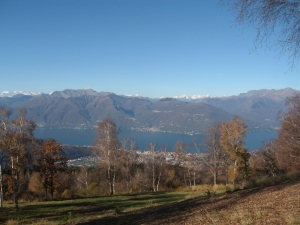
Walk westwards, through the thin wood of birch trees covering the top of Monte Sette Termini, keeping high above the hut Rifugio Sette Termini, now closed, from which you can have a beautiful view over the Valcuvia. Walk downhill across a meadow until you reach a watch turret, with a sight over Luino and Lake Maggiore, keeping left until you reach the junction with the SP23 coming from Montegrino. Turn right into this street as far as the first hairpin turning at which take the path into the pinewood on the right, walking downhill until you cross the forest road and keep walking downhill until you take a mule track still downhill on the left.
You will get to the dirt road on the left leading to the junction with the SP along which you will soon get to the small Lake of Montegrino. On the other hand, if you turn right you get to the Alpe del Campogino. Turn then right and in a few metres reach the junction on the left of the track which winds through the pinewood, equipped with some fitness facilities of the so called "Life Trail" (Percorso Vita) until you take the junction with a forest track on the left and then a dirt road on the right which goes past some trenches of the Linea Cadorna. Turn then left into the steep mule track downwards in the wood as far as a widening where the path turns closely right and where the most difficult part of the trail starts, climbing down obliquely and on a few hairpin turns on the steep incline above Biviglione. You eventually get to a junction with a street, closed to road vehicles, linking Biviglione to Cremenaga (424). Turn left and walk as far as the junction where the street turns right into Biviglione but keep left heading to Voldomino and continue, after climbing and descending a number of times, until you get to a small chapel and a meadow where you take the path on the right which goes steeply down along a ridge looking down above the valley of the River Tresa and Creva and which leads to the bridge over the River Tresa, just downstream of the dam. Climb up the opposite slope of the river where a kind of "stairs" of about 250 metres in length will enable fish to swim from Lake Maggiore to Lugano Lake. You will soon get to the Sp61 Via Turati where path 207, 3V Path, 7th leg, Muceno – Dumenza crosses and where the route ends.
{mosmap kml='images/file_gpx/413.GPX'}


